Some water supply wells are threatened or show a degradation in quality due to diffuse pollution, for example, due to high concentrations of nitrates or pesticides. Faced with this situation, managers need quantitative indicators to optimize their action plans and estimate their effectiveness.
With its expertise, Ageoce helps you prioritize intervention areas within catchment protection zones.
- Expertise in deterministic numerical modeling in hydrogeology
- International academic and institutional partners
- International publications in quantitative hydrogeology
- Determine the areas to intervene to act on the protection or recovery of water quality
- Determine the return times of actions taken in the territory
- Develop an action plan by prioritizing intervention areas
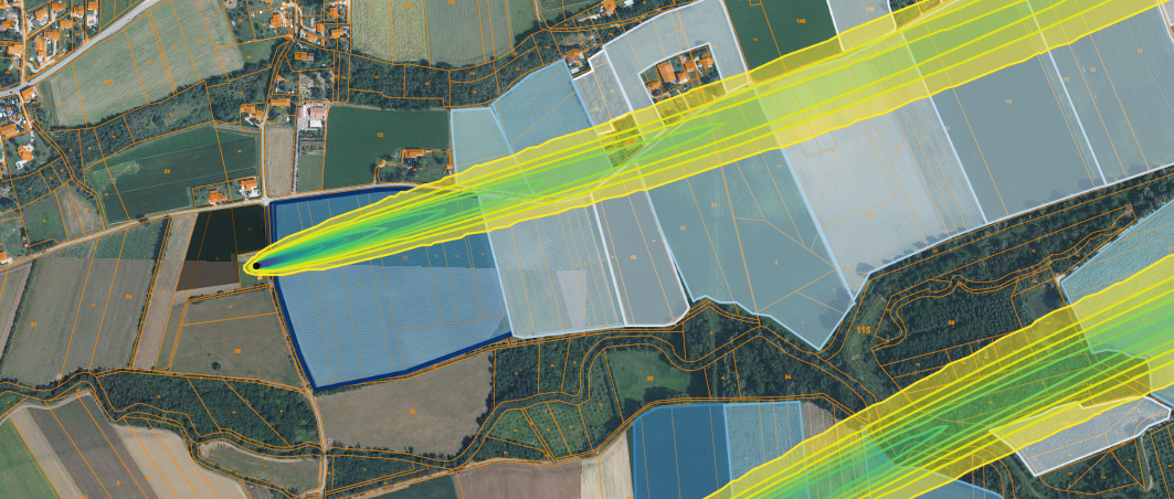
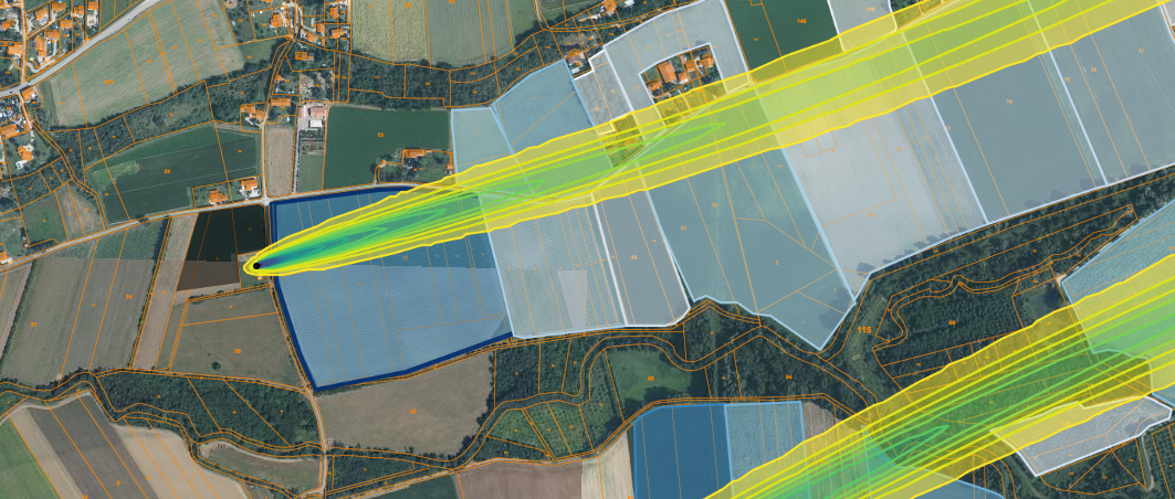
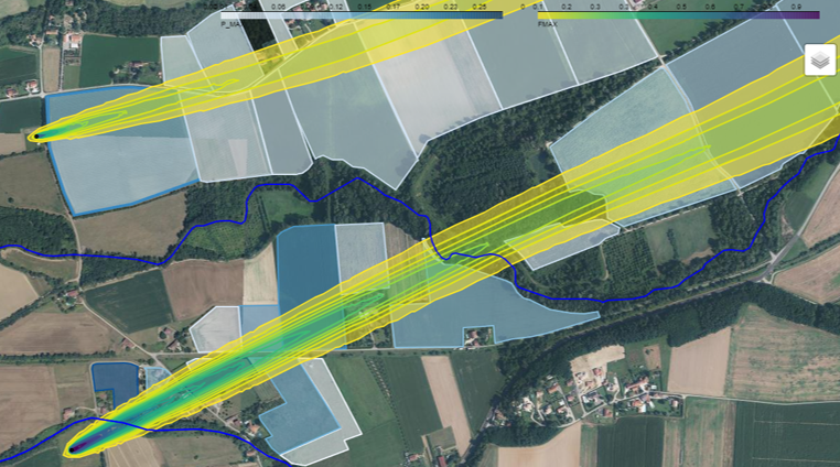
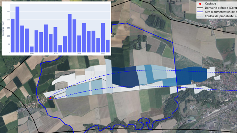
- Comprehensive mapping of areas contributing to the supply of threatened groundwater catchments
- Description of water transit times from their infiltration into the soil to their extraction
- Cross-referencing with the economic, industrial, and agricultural activities of your territory
Numerical modeling in hydrogeology has become an essential method to understand and control the impacts of human activities on groundwater resources.
With our expertise, we help you to manage your water resources and assess the potential impacts of your projects, such as the impact of a construction, a geothermal project, the protection of a catchment on groundwater, or the simulation of accidental pollution scenarios.
- Expertise in deterministic numerical modeling in hydrogeology, especially in urban hydrogeology.
- Academic and institutional partners and international recognition
- International publications in quantitative hydrogeology.
- Determine the impacts of a project on groundwater flow quality and temperature
- Determine the thermal impact on the aquifer and/or the protection perimeter of a low-temperature geothermal project
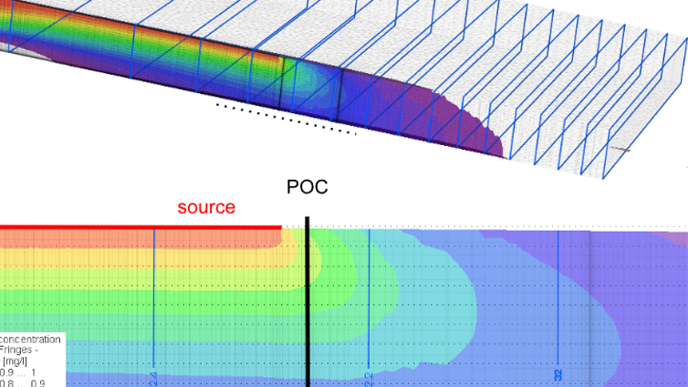
- Establish scenarios of accidental pollution and determine their impact in the context of protecting a groundwater resource.
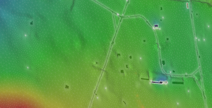
- Acquisition of all necessary data for the implementation of 3D numerical modeling scenarios: geological data, physical characteristics of soils, meteorological data.
- Conduct simulations in steady-state and transient conditions to determine flow conditions, thermal transfers, and pollutant transfers
- 3D modeling taking into account the unsaturated zone of the aquifer.
- Determination of groundwater travel times.
In recent years, some municipalities have struggled to ensure the supply of drinking water to the population: diffuse pollution and water stress exert strong pressure on available water resources.
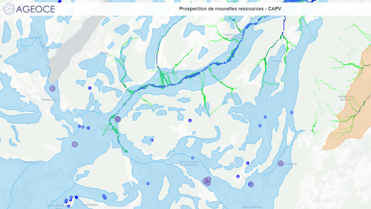
With our expertise, we can help you analyze geoscientific data available in your territory, for example in the context of prospecting for new resources.
- Expertise in deterministic numerical modeling in hydrogeology
- Academic and institutional partners and international recognition
- International publications in quantitative hydrogeology
- Results delivered in the form of interactive maps
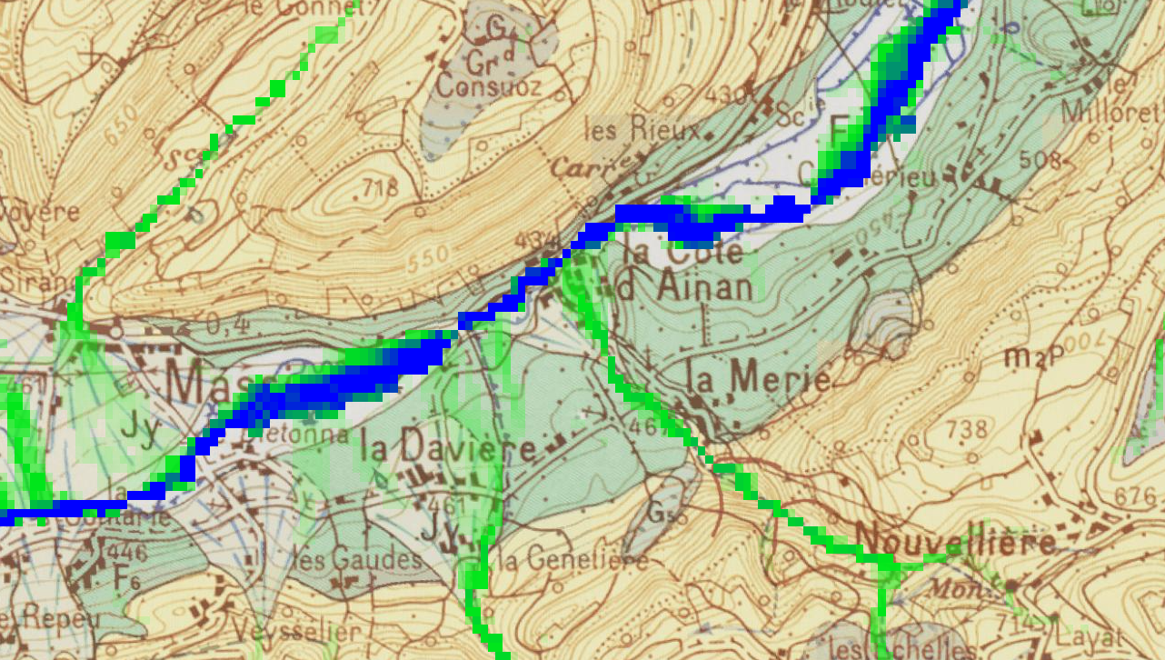
- Take stock of hydrogeological data available in a territory
- Map flows, determine the characteristics of available water resources
- Establish an action plan for the operational exploitation of new water resources
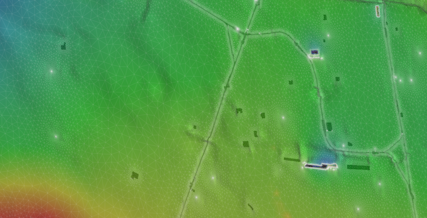
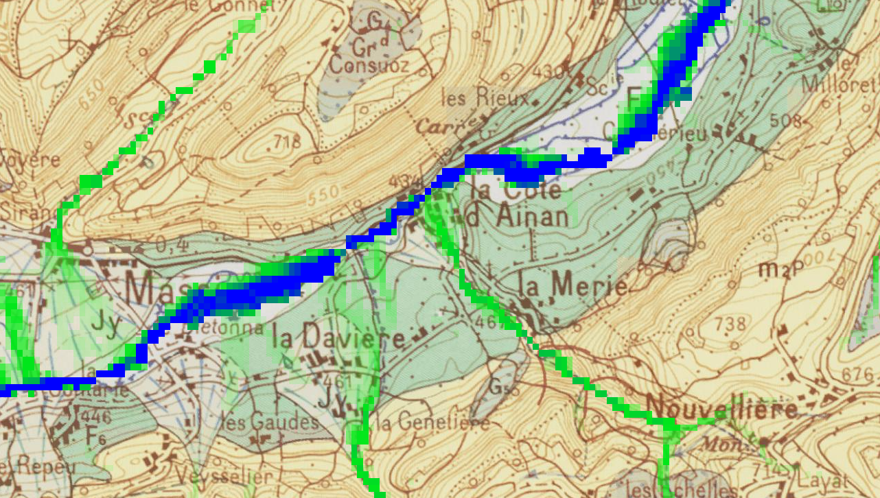
- Synthesis and interactive cartographic representation of all available hydrogeological data
- Analysis of data, evaluation of the availability and potential of identified water resources
- Mapping of surface and groundwater flows
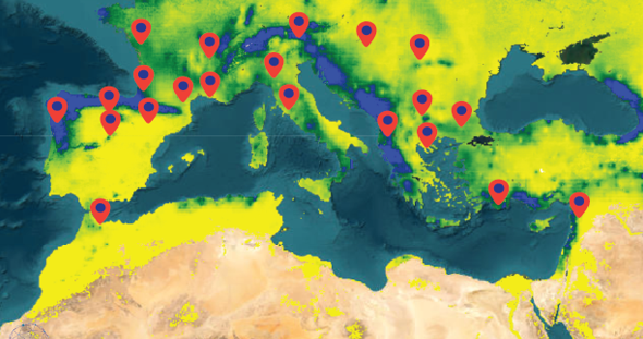
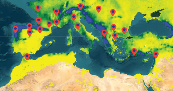
In recent years, episodes of water stress have caused major financial losses: shortages for drinking water supply, disruptions in the supply chain, damage to constructions, etc.
Thanks to satellite imagery, we offer you a comprehensive solution for monitoring your water resources: availability of surface and groundwater, soil moisture, state of vegetation.
- Expertise in geosciences
- Expertise in the processing of satellite data and Earth Engine technology
- Certification Google Cloud Professional Data Engineer
- Certification Google Cloud Professional Cloud Architect
- Monitor the state of water resources you exploit worldwide
- Anticipate the effects of climate change
- Contribute to the Water section as part of your ESG strategy and reporting
- Providing or integrating a water resource monitoring solution
- Data analysis to establish trends to quantify your exposure to droughts
- Support for the implementation of a drought adaptation strategy
RE-MED Project
Pays Voironnais
SIEPVG
COPARY
Accenta