
GeoClick
A geodata mining solution
Regulatory & land constraints, natural & environmental hazards, climate projections: GeoClick synthesizes the geographic information you need around your addresses.
- Global coverage for all environmental indicators
- National coverage - High quality and regulatory datasets covering the whole french national territory
- Rich data - A multi-thematic synthesis of constraints (urban planning, environment, risks, etc.)
- Productivity boost - geographic data mining and analysis in one click
Use Cases
![[object Object]](/_app/immutable/assets/hydroclick.CR6_e3Gd.png)
Environmental Consultants
Manage Water Resources and Control Exposure to Droughts
GeoClick allows you to synthesize, on a global scale, a range of information related to the management of water resources:
- Monitoring indicators related to the availability of water resources
- Monitoring indicators characteristic of droughts (SWI, NDVI, EVI, etc.)
- Monitoring land use indicators
Insurers
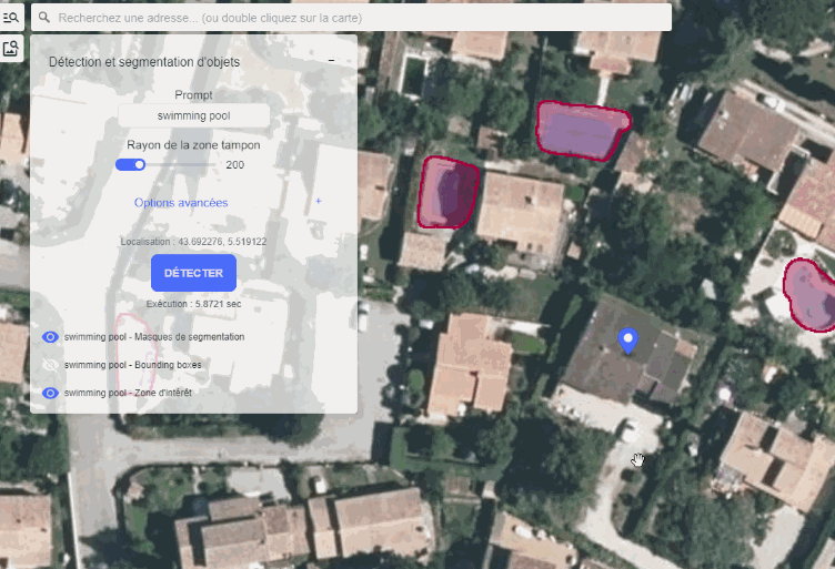
Geodata aggregation to provide insurance recommandations and assess building vulnerability to climate risks.
The GeoClick data enrichment module allows you to get all the available features at a given address:
- On-demand object detection around an addess
- Enrich the geographical context of an address with climatic, geoscientific and regulatory data
- Determine construction properties
![[object Object]](/_app/immutable/assets/architect.8zRObJu2.png)
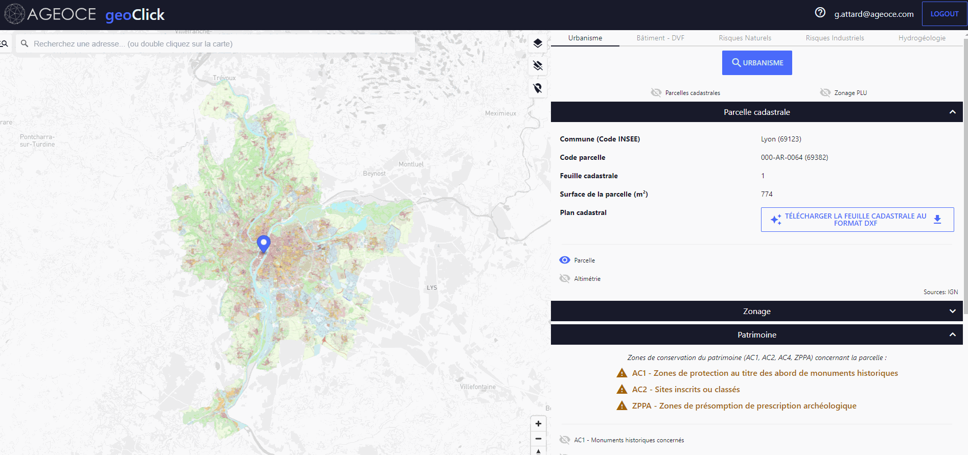
Architects
Conducting an architectural feasibility study
GeoClick allows you to synthesize all the elements required for a feasibility study:
- Identification of zones and planning regulations
- Identification of heritage constraints and environmental regulatory areas: surroundings of listed monuments, national parks, Natura 2000 areas, etc.
- Extraction of building and cadastral geometry and export to CAD software in DXF